What Is a Stroad, and Why Is It Dangerous?
Part road, part street, the all-too-common stroad creates dangerous conditions, especially for non-motorists like pedestrians and cyclists. But what makes them so deadly, and how can data on traffic conditions help find and fix them?
Jump Ahead
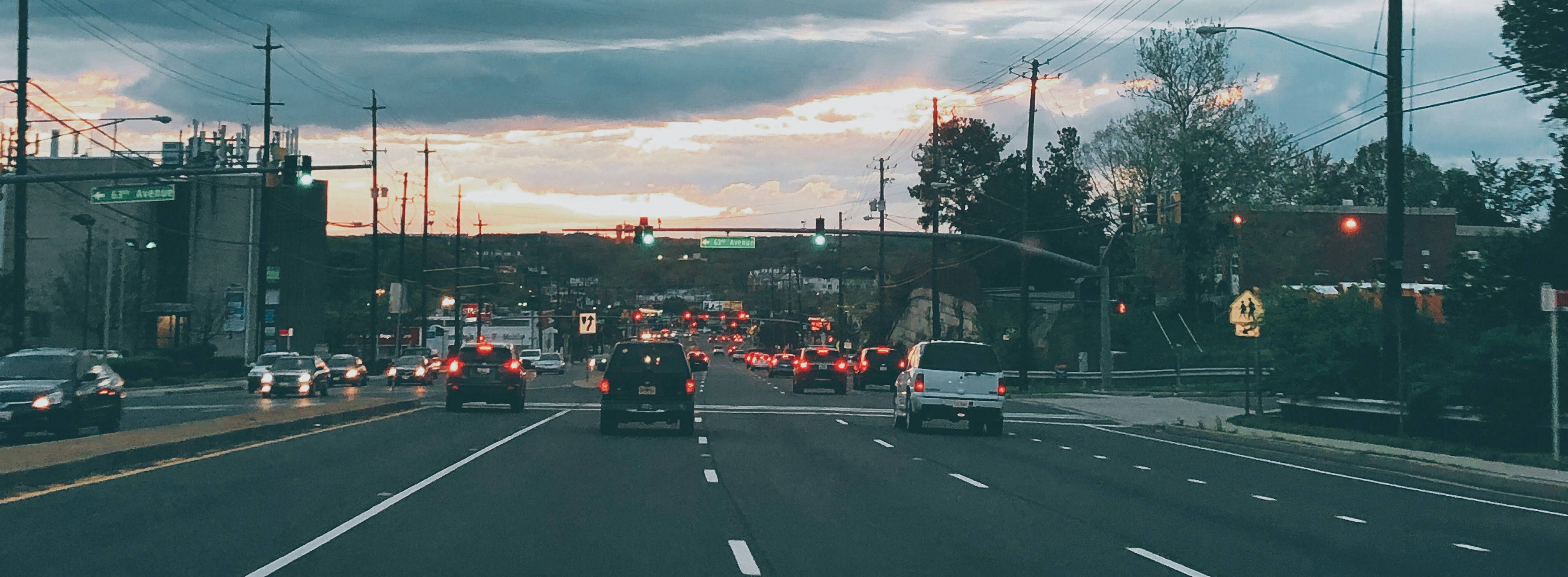
In our increasingly suburbanized North American landscape, stroads are a cornerstone of the car-centric transportation paradigm. These bare-bones high-speed roadways are often devoid of any pedestrian- or bike-friendly infrastructure, subjecting drivers and non-motorists alike to dangerous conditions when commuting, shopping, or accessing essential services.
The drawbacks of the stroad stem from its hybrid nature: it attempts to connect people with key destinations (goods, services, city amenities) while also getting people from point A to B as quickly as possible. Far from being the best of both worlds, stroads often fail to accomplish either of these goals particularly well.
So what exactly is a stroad, and how can we make them less dangerous? In this article, we’ll discuss:
- What is a stroad?
- The problem(s) with stroads
- How to fix stroads
- Data to improve safety on stroads
What is a stroad?
The term “stroad” was first coined in 2011 by Charles Marohn to describe a roadway that combines elements of a street and a road.1 So what is the difference between a street and a road?
Streets are destinations — they provide access to goods, services, and recreation. They are often found in dense urban cores, especially downtowns, where shops, restaurants, parks, salons, doctors’ offices, and more dot every corner. These kinds of roadways typically have fewer lanes, slower traffic, and signalized crosswalks to accommodate plenty of foot traffic.

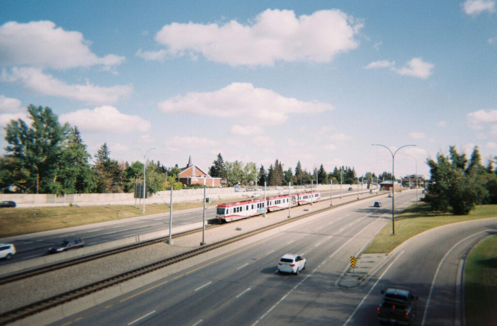
Roads, by contrast, connect destinations to one another, prioritizing efficient traffic flow to get people from point A to point B. Consider a highway between cities, or between a downtown core and a suburb or exurb. These types of roadways typically have more lanes, higher-speed traffic, and limited to no access for non-motorists like walkers and bikers.
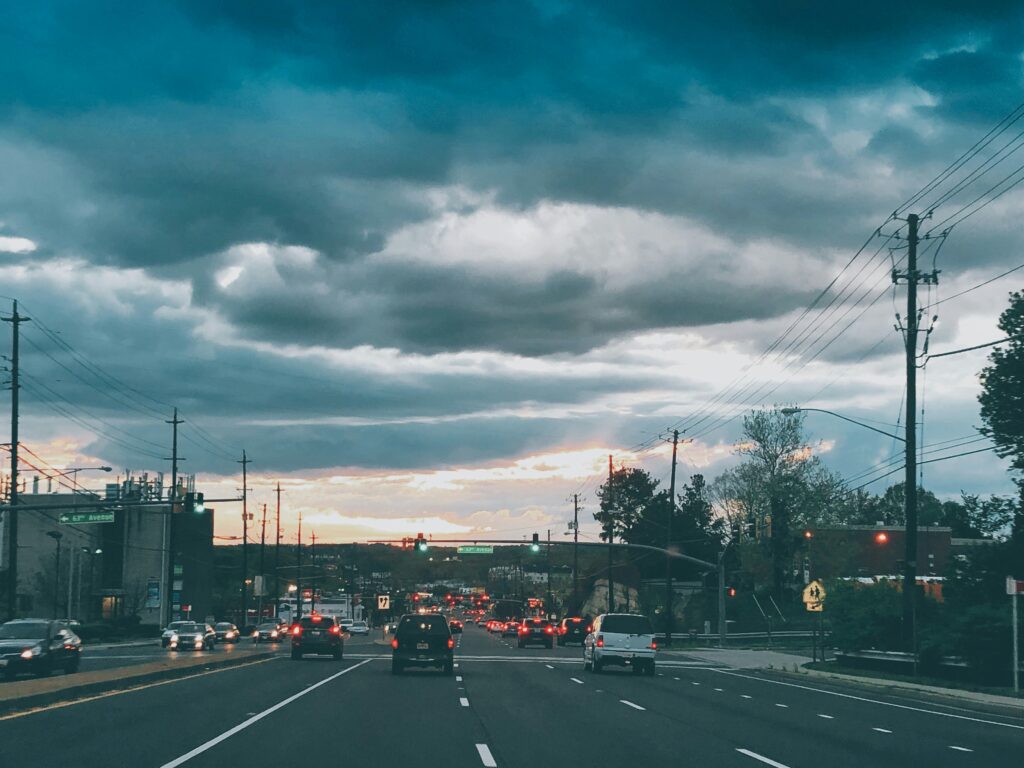
Stroads combine elements of both, acting as both destination and thoroughfare, which results in wide, high-speed roadways with sparse walking and biking infrastructure that are nevertheless crucial access points for goods, services, and recreation. These kinds of roadways are common around malls, strip malls, and other suburban hubs, but also frequently cut through urban cores — many downtown Main Streets are also stroads. Wherever they crop up, they usually feature speed limits between 20 and 50 miles per hour. [2]
When stroads manifest in the suburbs, it’s often because roads that were once used to connect suburban residents to the downtown core become attractive places for new shopping centers, restaurants, movie theaters, and more, boasting plenty of cheap space for sprawling supercenters and parking lots. Thus, roads that become host to these kinds of destinations are often doomed to morph into the dangerous stroad hybrid.
Stroads are also common in urban cores, especially where priority is placed on accommodating the high vehicle throughput that is common in these areas.
The problem(s) with stroads
In addition to being dangerous, stroads also have other negative impacts on public health and the local economy.
Why are stroads dangerous?
As mentioned above, stroads lack many of the necessary features that make streets safe for walking and biking, such as signalized crosswalks, protected bike lanes, slow vehicle speeds, and short crossing distances.
But it’s not just Vulnerable Road Users who experience dangerous conditions on stroads. These roadways are also difficult for drivers to safely navigate due to high-speed traffic across multiple lanes with many entry and exit points from driveways and parking lots providing access to roadside destinations.
Stroads often subject drivers to unprotected left turns to cross multiple lanes of high-speed traffic, or right turns where they could easily collide with cyclists and pedestrians traveling in the same direction across unmarked driveway crossings.
How do stroads impact emissions?
Stroads incentivize vehicle travel over lower emission forms of transportation like walking and biking. This, compounded by the fact that high-speed travel produces more emissions than slower driving, makes stroads emissions hotspots.
This not only contributes to climate-harming greenhouse gases, but also worsens air quality for those who live near these hybrid roadways.
Are stroads bad for the economy?
Although stroads connect consumers with shopping centers and other businesses, many are also unattractive and costly, compromising their ability to support the local economy.
Vast, undifferentiated expanses of asphalt and concrete are common to stroads, multi-lane roadways and parking lots dominate the landscape. Coupled with poor safety, this creates an uninviting environment, disincentivizing frequent trips and extended visits.
These factors also make stroads costly. While these high-volume, high-speed roadways must undergo expensive maintenance due to considerable wear and tear, they also often generate less economic activity and property tax revenue than true streets do. [3]
See how dangerous traffic speeds impact walking and biking in your region
Download Safe Speed IndexHow to fix stroads
Fixing a stroad isn’t always simple, because they represent a confluence of competing land use and transportation goals: promote efficient vehicle travel while also facilitating economic opportunity and access to goods, services, and recreation.
A stroad usually evolves because land use practices have already allowed for business developments along an existing roadway, at which point it is too late to prevent the evolution of a stroad, but not too late to fix it.
Can stroads be prevented?
But it is possible to prevent the creation of a stroad in the first place through intentional land use practices. This would involve restricting new development along existing roads and allowing for more dense development along more people-friendly streets. Restricting the expansion of existing roadways (through lane widening or added lanes) can also help prevent street-to-stroad evolutions.
Similarly, reducing or eliminating parking minimums can allow for denser, less car-dependent hubs of development while also incentivizing non-vehicle modes of travel.
Preventing stroads could also involve converting roads into streets when new developments are proposed along existing roads. Below, we’ll explore some strategies for turning roads or stroads into streets.
Turning stroads into roads
Because stroads already have businesses, services, and/or city amenities in residence, fixing a stroad usually means turning it into a proper street. Turning a stroad into a road is not always possible, because it might require removing existing destinations and potentially relocating them elsewhere — a costly, unpopular, and time-consuming prospect for businesses and residents alike.
In cases where stroads are converted into roads, this means prioritizing vehicle throughput, minimizing entrance and exit points along the road (e.g. reducing the number of driveways leading to shopping centers and other roadside destinations) and eliminating pedestrian and bike access to the road (potentially creating separated bikeways and pedestrians paths).
Turning stroads into streets
To make stroads safer, more sustainable, and better for the economy, cities can explore redesigning roadways to implement more street-like elements.
One powerful tool for turning stroads into streets is the road diet. Road diets remove or repurpose existing lanes of traffic in order to create safer, lower speed corridors. While this tactic is sometimes controversial due to concerns that removing lanes will increase congestion, careful traffic analysis often reveals that road diets do not create significant delays in travel time, especially if they make roadways safer for non-vehicle modes of travel or reroute a portion of traffic to other high-capacity roads.
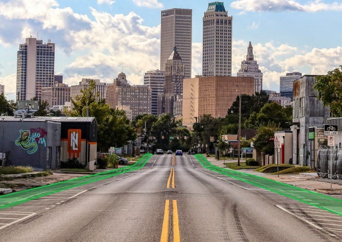
Similarly, adding multimodal infrastructure, especially infrastructure focused on bike and pedestrian safety such as protected bike lanes, signalized crossings, and pedestrian islands can help eliminate the common dangers of stroads. A Complete Streets policy can establish helpful guidelines for turning stroads into streets that accommodate all road users.
In addition to road diets, other traffic calming tactics such as reducing speed limits, narrowing lanes, or adding street art and landscaping can protect vulnerable road users from one of the top factors contributing to high traffic fatality rates: dangerous vehicle speeds. While street art and landscaping have been shown to reduce average driving speeds, they also help beautify stroads, making them more inviting and better for business. Adding lighting and benches can also further these goals.
Reducing parking, especially in locations with vast parking lots such as shopping centers, also helps disincentivize vehicle use and encourage other modes of travel like public transit, walking, and biking. Furthermore, eliminating parking can also free up space for housing, parks, dining courts, or other developments that give people reasons to visit more frequently and for longer periods of time, boosting economic activity.
In any case, converting a stroad into a street often takes time and may involve multiple strategies, so cities should focus on incremental improvements. [3]

Data to improve safety on stroads
To find and fix stroads effectively, analyzing current traffic conditions is crucial. The following metrics can help planners and engineers understand where stroads are putting people at risk and determine the best strategies to address them:
- Vehicle speeds – to pinpoint which roadways may qualify as stroads and monitor risk for Vulnerable Road Users like pedestrians and cyclists
- Biking and Walking activity – to understand where Vulnerable Road Users contend with dangerous conditions and where to prioritize infrastructure to improve their safety and connectivity
- Vehicle volumes – to understand roadway capacity and help assess whether a stroad should be converted into a road or a street
- Routing and Origin-Destination patterns – to evaluate the potential for stroad-to-street conversions and where traffic could be rerouted or shifted to other modes like public transport
- Turning Movement Counts – to determine where traffic lights, signalized crosswalks, or signal retiming can keep traffic flowing while improving safety
For a comprehensive guide to transportation safety analytics, download our Practitioner’s Guide to Transportation Safety.
- Ben Abramson. Strong Towns. “5 Telltale Signs You’re on the Stroad From Hell.” January 19, 2023. https://www.strongtowns.org/journal/2023/1/19/5-telltale-signs-youre-on-the-stroad-from-hell
- Strong Towns. “What’s a STROAD and Why Does It Matter?” March 2, 2018. https://www.strongtowns.org/journal/2018/3/1/whats-a-stroad-and-why-does-it-matter
- Reliance Foundry. “Bad Urban Design: How do you fix a stroad?” https://www.reliance-foundry.com/blog/how-to-fix-a-stroad
See where vehicle speeds are putting all road users at risk
Download Safe Speed IndexReady to dive deeper and join the conversation?
Explore the resources listed above and don’t hesitate to reach out if you have any questions. We’re committed to fostering a collaborative community of transportation professionals dedicated to building a better future for our cities and communities.