What Is a Vulnerable Road User?
As the transportation industry grapples with the deadly impacts of vehicle-centric infrastructure, new requirements could shift focus onto road users outside the vehicle — vulnerable road users. But what is a vulnerable road user, and can this safety classification actually help agencies save lives?

Jump Ahead
When it comes to road safety outcomes, it’s no surprise that some road users are more vulnerable than others. While drivers are protected by vehicle safety standards and road design that is tailored to their mode of travel, those who walk, bike, or use other forms of transportation often face dangerous roadway conditions, contributing to record high fatality rates for cyclists and pedestrians, even though walking activity is down nationwide. [1]
This safety disparity is nothing new, nor is the term “vulnerable road user,” but up until recently, much of the emphasis on road safety was placed on vehicle safety standards and making roads safe for drivers. Now, transportation professionals are beginning to pay special attention to vulnerable road users as they seek to create safer mobility systems for those outside vehicles.
In a move that underscores the growing attention toward Vulnerable Road Users (VRU), the Federal Highway Administration (FHWA) on February 21, 2024 proposed a change to the Highway Safety Improvement Program (HSIP) regulations, which would require each state to perform a vulnerable road user safety assessment as part of their Strategic Highway Safety Plan (SHSP). And some states, such as West Virginia, have already created Vulnerable Road User risk assessment tools to predict where VRU-related crashes are most likely to occur.
So what exactly is a vulnerable road user, and how can we make them less vulnerable? In this article, we’ll discuss:
- What are vulnerable road users?
- What is a vulnerable road user safety assessment?
- How to make streets safer for vulnerable road users
- Data to support vulnerable road users
What Is a Vulnerable Road User?
The National Safety Council (NSC) broadly defines a Vulnerable Road User as anyone not protected by an outside shield (such as the body of a car) while on the road. [2] This definition highlights the increased risk of injury and death road users face in collisions when they are not protected by a vehicle or other “shield.”
More narrowly, the term Vulnerable Road User is typically used to refer to pedestrians and cyclists, but may also apply to motorcyclists, road workers (who are also considered pedestrians), and other road users not inside a vehicle such as a car, truck, or bus.
This classification isn’t merely conceptual. According to data from the National Highway Traffic Safety Administration (NHTSA), VRUs account for a growing and disproportionate share of all traffic fatalities in the U.S., increasing by roughly 1% between 2017 and 2021. [3] This increase happened even while the number of average daily walking trips declined by 36% nationwide between 2019 and 2022, based on StreetLight’s data, underscoring just how dangerous U.S. roadways are for nonmotorists.

What Is a Vulnerable Road User Safety Assessment?
A Vulnerable Road User Safety Assessment is a study conducted by a transportation agency — usually a state DOT — to measure safety performance with respect to vulnerable road users. Chiefly, it quantifies fatality and injury rates for VRUs and compares this to overall fatality and injury rates. [4]
A Vulnerable Road User Safety Assessment also requires agencies to identify a set of projects and strategies aimed at mitigating the safety risks faced by vulnerable road users, which could include adding bike and pedestrian infrastructure or reducing speed limits on high-risk roadways. We’ll explore potential safety improvements for vulnerable road users in more detail below.
How to Make Streets Safer for Vulnerable Road Users
To make streets safer for VRUs, it is necessary to go beyond the car-centric paradigm that dominates transportation in the U.S. and build people-first transportation networks that support safe access to all modes of travel.
There are many ways to work toward this paradigm shift and ensure safer streets for all road users, but policy and infrastructure improvements are critical to address the systematic dangers of our transportation networks that make road users vulnerable in the first place.
A Complete Streets policy can encourage planners to identify and address infrastructure gaps that not only impact Vulnerable Road Users, but other groups that face dangerous disadvantages on the road, such as people with disabilities.

Safe Infrastructure for Pedestrians and Cyclists
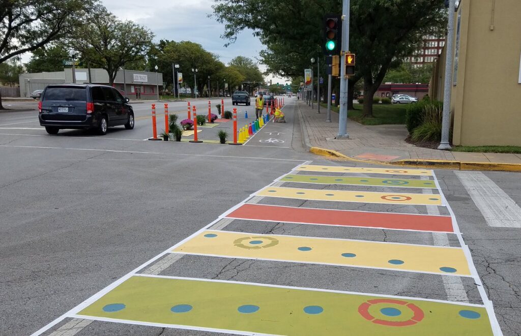
Safer road infrastructure can take many forms, but a multimodal focus is essential to make streets safer for Vulnerable Road Users. Pedestrian and cycling infrastructure are obvious starting points, since Vulnerable Road Users are primarily walkers and bikers.
Some common infrastructure improvements proven to make streets safer for cyclists and pedestrians include:
- Pedestrian islands, widened sidewalks, and bulb-outs
- Protected bike lanes, bikeways, and shared-use paths
- Signalized crosswalks
- Daylighting
- Reduced speed limits
- Traffic signal retiming
- Lane narrowing and lane reductions
For example, in the video below, transportation professionals from Pittsburgh explain how they rebuilt Fern Hollow Bridge to be safer for walkers and bikers after its headline-making collapse in 2022. They did this by adding the city’s first jersey barrier protected bike lanes, lowering the speed limit, and simplifying a complex intersection where drivers were taking risky turns that endangered Vulnerable Road Users.
Similarly, when North Kansas City, Missouri installed a new protected bike lane on Armour Road — a principal thoroughfare running through the city’s downtown and adjacent commercial area — a before-and-after analysis confirmed that the new bike lane boosted bike ridership and reduced vehicle speeds without causing congestion, leading to a safer corridor for Vulnerable Road Users.
Traffic calming measures such as road diets and reduced speed limits can also help address one of the primary factors leading to serious injury and death for Vulnerable Road Users: dangerous vehicle speeds. When ranking speed conditions for the top 30 most populated U.S. metro areas, StreetLight found that among the bottom 25 (those with the most dangerous speeds), 33% of roadways have average vehicle speeds above 35 mph. At these speeds, pedestrians are roughly five times more likely to die from collisions, according to data from the AAA Foundation.

Safe Infrastructure for Other Vulnerable Road Users
The unique needs of motorcyclists and riders of other powered two- and three-wheel vehicles such as mopeds, e-bikes, and e-scooters often get overlooked, even in the context of Vulnerable Road User initiatives.
In fact, some definitions of Vulnerable Road User specifically exclude motorcyclists, such as that put forth by the FHWA in the Vulnerable Road User Safety Assessment Guidance Memorandum issued in October 2022. However, the World Health Organization (WHO) recognizes motorcyclists as VRUs and offers guidance on how to design safer roads for motorcycles. [5]
Safety programs for these road users have typically focused on education and training around defensive driving and the use of Personal Protective Equipment (PPE) like helmets.
But infrastructure is also key to improving safety for these road users. The WHO identifies road design elements such as lane and shoulder width, surface friction, curve type and radius, sight distances, lighting, and turning provisions, including signal phasing at intersections to have significant impact on the severity of motorcycle crashes. Put simply, whenever road design compromises the stability of a motorcycle (such as on sharp curves) or the visibility of motorcyclists (such as poor sight distances or lighting conditions), the risk of severe crashes increases.

Exclusive motorcycle lanes have been proven to improve motorcyclist safety, while protected turn lanes, traffic calming measures, and road surface treatments to increase friction are also identified by the WHO as promising countermeasures to reduce crash rates and crash severity for this group.
Other studies also identify the design of guardrails and other roadside barriers, especially along curves, as particularly impactful to motorcycle safety. Motorcyclists account for a disproportionate number of vehicle-guardrail fatalities in the U.S., but there is some evidence that when existing guardrails are retrofitted with a barrier rail below the main guardrail, this can prevent motorcyclists from hitting the supporting poles of a guardrail, making these impacts less fatal. [6]
See how dangerous traffic speeds impact walking and biking in your region
Download Safe Speed IndexData to Support Vulnerable Road Users
Traditional data collection methods like physical roadway sensors and surveys often do not collect data on Vulnerable Road Users, leaving data gaps that can make it difficult to diagnose and address safety issues for VRUs, measure the impact of past infrastructure changes, or even incorporate vulnerable road users into the planning process. While manual counts and surveys directed specifically at pedestrians and cyclists can help fill these gaps, they can also be costly, time-consuming, and subject to bias and sample size issues while also putting agency staff at risk while they are stationed along busy roadways.
Transportation analytics using a big data approach can often offer a more comprehensive and granular view of VRU activity on roadways, while also providing insights into vehicle speed, volumes, and other factors impacting VRU safety.To diagnose dangerous roadway conditions Vulnerable Road Users face in your region, the following metrics can be helpful:
- Vehicle Speeds – to understand where unsafe speeds put VRUs at the highest risk of fatal crashes
- Active Transportation Activity – to map and measure VRU exposure and prioritize corridor improvements
- Vehicle Volumes – to further contextualize VRU exposure and understand how potential road design changes may impact capacity and congestion
- Turning Movement Counts – to understand safety conditions at intersections, where most collisions occur
Before-and-after analyses of each of these metrics can also help evaluate the success of past projects, justify funding requests, and gain public or political support for future improvements.
For example, a StreetLight analysis of Oakland’s Grand Avenue used data on vehicle speeds, pedestrian activity, and routing patterns to show that a road diet could help improve safety on this corridor without causing congestion.
In Pittsburgh, analysts also overlaid bike and pedestrian activity onto crash data to understand the factors that lead to crash severity and prioritize equitable safety improvements throughout the city.
The video below provides a helpful introduction to how agencies can use these sorts of analyses to diagnose dangerous conditions and prioritize safety investments.
For a comprehensive guide to transportation safety analytics, download our Practitioner’s Guide to Transportation Safety.
- Insurance Institute for Highway Safety, “Fatality Facts 2021, Pedestrians.” May 2023. https://www.iihs.org/topics/fatality-statistics/detail/pedestrians
- National Safety Council. “Position/Policy Statement, Vulnerable Road Users.” https://nsc.org/getattachment/d5babee6-582d-4e66-804f-8d06f9b021a4/t-vulnerable-road-users-147
- National Highway Traffic Safety Administration. “National Statistics.” https://www-fars.nhtsa.dot.gov/Main/index.aspx
- Federal Highway Administration. “Vulnerable Road User Safety Assessment Guidance.” https://highways.dot.gov/safety/hsip/vru-safety-assessment-guidance
- World Health Organization. Powered two-and three-wheeler safety: a road safety manual for decision-makers and practitioners. 9 October 2022. https://www.who.int/publications/i/item/9789240060562
- Georgene M. Geary, Infrastructure Measures to Protect the Unrecognized Vulnerable Road User: Motorcyclists. Eng. Proc. 2023, 36, 36. https://doi.org/10.3390/engproc2023036036

See where vehicle speeds are putting vulnerable road users at risk
Download Safe Speed IndexReady to dive deeper and join the conversation?
Explore the resources listed above and don’t hesitate to reach out if you have any questions. We’re committed to fostering a collaborative community of transportation professionals dedicated to building a better future for our cities and communities.